Thai App Center ขอแนะนำ OsmAnd — Offline Travel Maps & Navigation
OsmAnd is an offline navigation application with access to the free, worldwide, and high-quality offline maps.
Enjoy voice and visual offline navigation, viewing points of interest, creating and managing GPX tracks, using contour lines visualization and altitude info (through plugin), a choice between car navigation, cycle navigation or directions in the pedestrian mode, OSM editing and much more. Just download your free maps and get the following:
GPS navigation
• You can choose between offline (no roaming charges when you are abroad) or online (faster) mode
• Turn-by-turn voice guidance leads you along the way (recorded and synthesized voices)
• Driving routes get rebuilt whenever you deviate from them
• Lane guidance, street names, and estimated time of arrival will help along the way
• To make your trip safer, day/night mode switches automatically
• You can choose to show speed limit, and get reminders if you exceed it
• You can searches destinations by address, by type (e.g.: parking, restaurant, hotel, gas station), or by geographical coordinates
• Different modes for cycling routes
• You can record your own or upload a GPX track and follow it using GPS navigation
• OSM Public Transport
Map
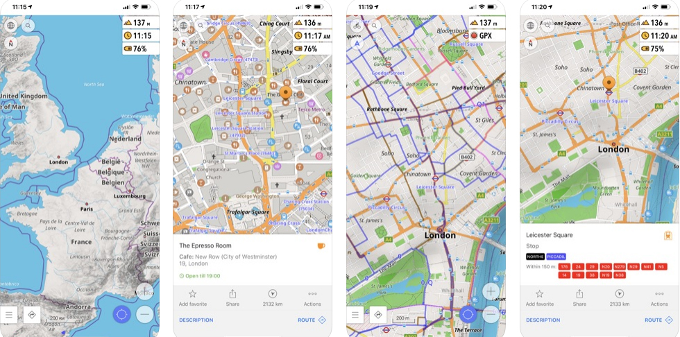
• Displays POIs (points of interest) around you
• Offline search helps you find the places of interest by opening hours, payment method and other parameters
• Adjusts the map to your direction of motion (or compass)
• Share your location so that your friends can find you
• Shows bicycle routes, hiking paths, and other types of roads
• Allows you to choose how to display names on the map: in English, local, or phonetic spelling
• Displays specialized online tiles, satellite view (from Bing), different overlays like touring/navigation GPX tracks and additional map layers
Nautical Maps
• Information about sea objects and a contour map of sea depth. Basically convenient sea maps you can use without the internet.
Skiing
OsmAnd ski maps plugin enables you to see ski tracks with the level of complexity and some additional information, like the location of lifts and other facilities.
OpenStreetMap Data
• High-quality information from the best collaborative projects of the world
• OSM data available per country or region
• Compact offline vector maps updated at least once a month
• Choice between complete region data or just road network (Example: All of Japan is 700 MB or 200 MB for the road network only)
Cycling
• GPS navigation in cycling mode builds your route using cycling paths
• You can see your speed and altitude
• GPX recording option enables you to record your trip and share it
• Via additional plugin you can enable displaying contour lines and hill-shading
Walking, hiking, city tour
• The map shows you walking and hiking paths
• GPS pedestrian navigation mode builds your route using walking paths
• You can upload and follow a GPX route or record and share your own hiking routes
Public transport
• Navigation on public transport: Metro, Buses, Tram and so on.
Contribute to OSM
• Report data bugs
• Upload GPX tracks to OSM directly from the app
• Add POIs and directly upload them to OSM (or later if offline)
OsmAnd is open-source and actively being developed. Everyone can contribute to the application by reporting bugs, improving translations or coding new features. The project is in a lively state of continuous improvement by all these forms of developer and user interaction. The project progress also relies on financial contributions to fund coding and testing of new functionalities.
Approximate map coverage and quality:
• Western Europe: ****
• Eastern Europe: ***
• Russia: ***
• North America: ***
• South America: **
• Asia: **
• Japan & Korea: ***
• Middle East: **
• Africa: **
• Antarctica: *
Download OsmAnd — Offline Travel Maps & Navigation
Android
iOS